

History of Yardley Borough
Good neighbors since 1682
Yardley was settled by William Yeardley (as the name was then spelled), a Quaker minister seeking religious freedom who emigrated to America from England with his wife, three sons and a servant in July 1682. Before leaving England, he made an agreement with William Penn to purchase a 519-acre tract for ten pounds sterling. He settled on Dolington Road and built a log cabin and later a stone house called "Prospect Farm". The Yardley family occupied the land for more than 150 years.
When a town plan was prepared in 1807 and several lots were laid out, Yardley was beginning its growth. Following the completion of the Bristol-New Hope section of the Delaware Canal in 1831, new commerce and trade poured into the town, then called "Yardleyville". Early industries included a spoke and handle factory, sawmill, felloe factory, plate and plaster mill and two flour mills. The Post Office was established in 1828. In 1835, Yardley's first covered bridge was built across the Delaware River at the foot of what is now Afton Avenue.
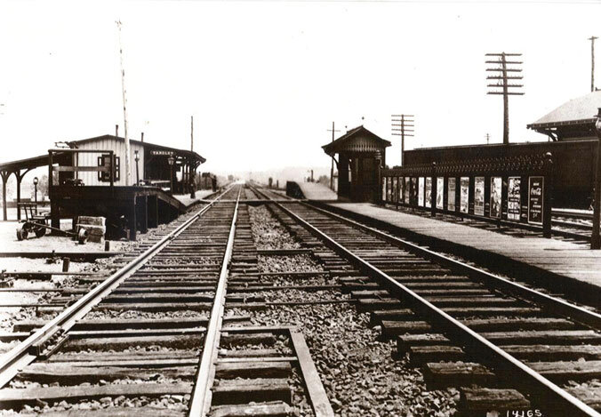
In 1876, the railroad opened its New York branch through Yardley and erected a station just south of the established village. To avoid confusion with Yardville, N.J., the railroad campaigned to shorten the name Yardleyville and in 1883 the Post Office adopted the name "Yardley". By 1880 the town had a population of 820 (according to the 2000 census, the population is now 2,498), and in 1895 it was incorporated into a borough.


A Unique Bucks County Village - Historic Yardley
Yardley Borough is located along the Delaware River and is bordered by Lower Makefield Township. Until the mid-twentieth century, the surrounding countryside was still relatively open and in agricultural use. While the last two decades have seen the farmland in the surrounding area give way to large residential developments, much of the core of Yardley, where the historic district is located, has retained its historic integrity.
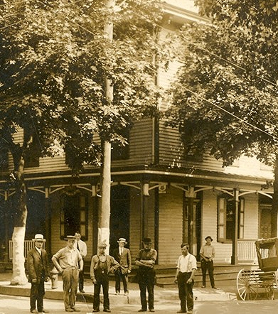
The historic district is a collection of approximately two hundred structures located in the heart of the Borough. The majority of structures are frame, two-and-a-half story, single family residences. Most date from mid or late nineteenth century, a period which encompasses the time between the opening of the Delaware Division of the Pennsylvania Canal and Yardley's incorporation as a Borough. Also located within the historic district are several houses of worship, the municipal building, canal bridges, aqueducts, and Lake Afton, a manmade mill pond.
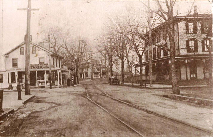
Yardley developed from an early eighteenth century mill seat and ferry crossing for the Delaware River. The core of the town and historic district is located at the intersection of Afton Avenue and Main Street. The only concentration of historic structures east of the Delaware Canal is located along the south side of East Afton Avenue, which was the site of a bridge that spanned the Delaware River between 1835 and 1955. The streetscape along East Afton Avenue presents small two-and-a-half story stone houses which mirror the street's pre-canal development.
The majority of the buildings within the historic district are found on South Main Street.
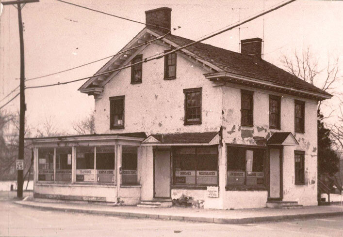
Both sides of the street are lined with closely set buildings, many of which have been adapted to commercial use. Even if used commercially, the buildings reflect a sensitivity to architectural integrity. Landscaping fosters this impression. The trees and shrubs planted within building setbacks from the street enhance the residential feel of the neighborhood, and in turn, the entire historic district. Rich in diversity of style, houses along South Main Street include examples of Second Empire, Queen Anne, and enhanced Victorian Gothic architecture.

The historic district continues along the west side of South Main Street. Juxtaposed with late nineteenth century commercial buildings is a shopping center constructed in the mid 1900s. On the east side of the street is the last nineteenth century brownstone bank building. Continuing south, the brick Colonial Revival Post Office and Borough Hall, constructed in 1916, are found.
The historic district encompasses both sections of Canal Street, which runs parallel to the Delaware Canal. The areas in both sections are dotted with small, predominantly frame structures dating from 1840. Along the southernmost section of Canal Street is the small, frame Yardley-Bethel A.M.E. Church built in 1877 and several early twentieth century double houses.
The net result of Yardley's growth from a mill seat and ferry crossing into an independent borough is a distinct assemblage of eighteenth and nineteenth century buildings with a well-defined and cohesive historic district. This is due to the very small percentage of intrusion within the historic district boundaries and the overall effect of the design and setting of the town's buildings. The vast majority of the buildings are oriented to narrow streets and are set closely to each other on this deep lots. Although the buildings in the commercial district are less unified in design, size and integrity, these adapted buildings do not detract from the historic elements that give the historic district its distinct sense of time and place. There is a true sense of entering a town when one enters Yardley Borough.